 https://www.geo-k.co/wp-content/uploads/2016/03/DSC00314_low-e1457531648511_1.png
638
1024
admincl
https://www.geo-k.co/wp-content/uploads/2019/11/NEW_GEO-K_logo_trasp1.png
admincl2016-03-09 12:18:452020-01-15 15:34:58RFIDrone: when a drone reads radiofrequency
https://www.geo-k.co/wp-content/uploads/2016/03/DSC00314_low-e1457531648511_1.png
638
1024
admincl
https://www.geo-k.co/wp-content/uploads/2019/11/NEW_GEO-K_logo_trasp1.png
admincl2016-03-09 12:18:452020-01-15 15:34:58RFIDrone: when a drone reads radiofrequencySOIL SEALING DETECTION
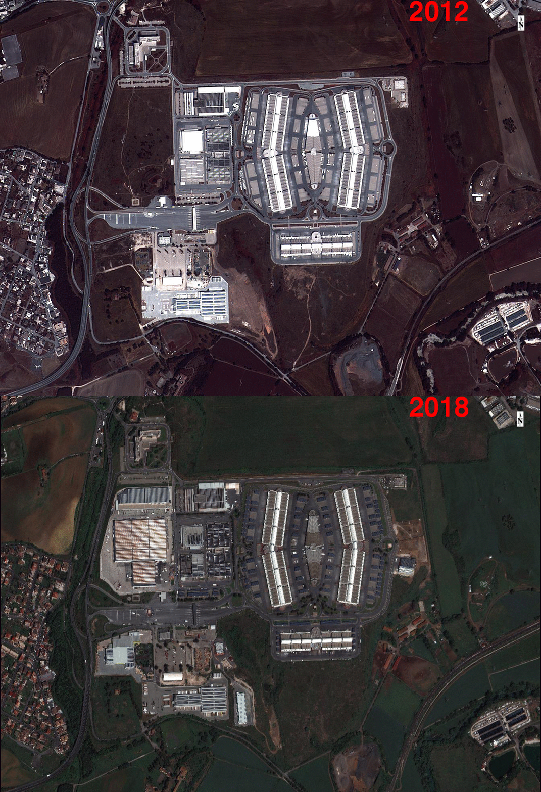
Soil sealing identifies the conversion from healthy green land to artificial industrialized and urban areas. It is connected with various criticalities, such as the impoverishment of agricultural land, the unbalanced heat exchange, the variation of drainage conditions of soils, the spatial and ecological fragmentation, and urban dispersion. On the contrary, conserving open space and farmlands creates economic, environmental, and social benefits, thus reducing the rate of consumption is desirable and it is one of major objectives for European Council and United Nation who aim to control and reduce it to zero toward 2050.
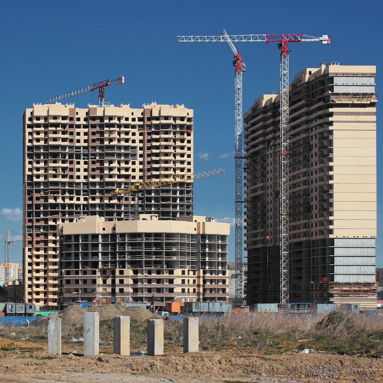
In the last years, the need for measuring soil sealing has consolidated. However, the problem is sometimes tackled using qualitative methods, without considering to introduce some indicators of settlement sustainability that could take into account the quantity and the shape of new conversions.
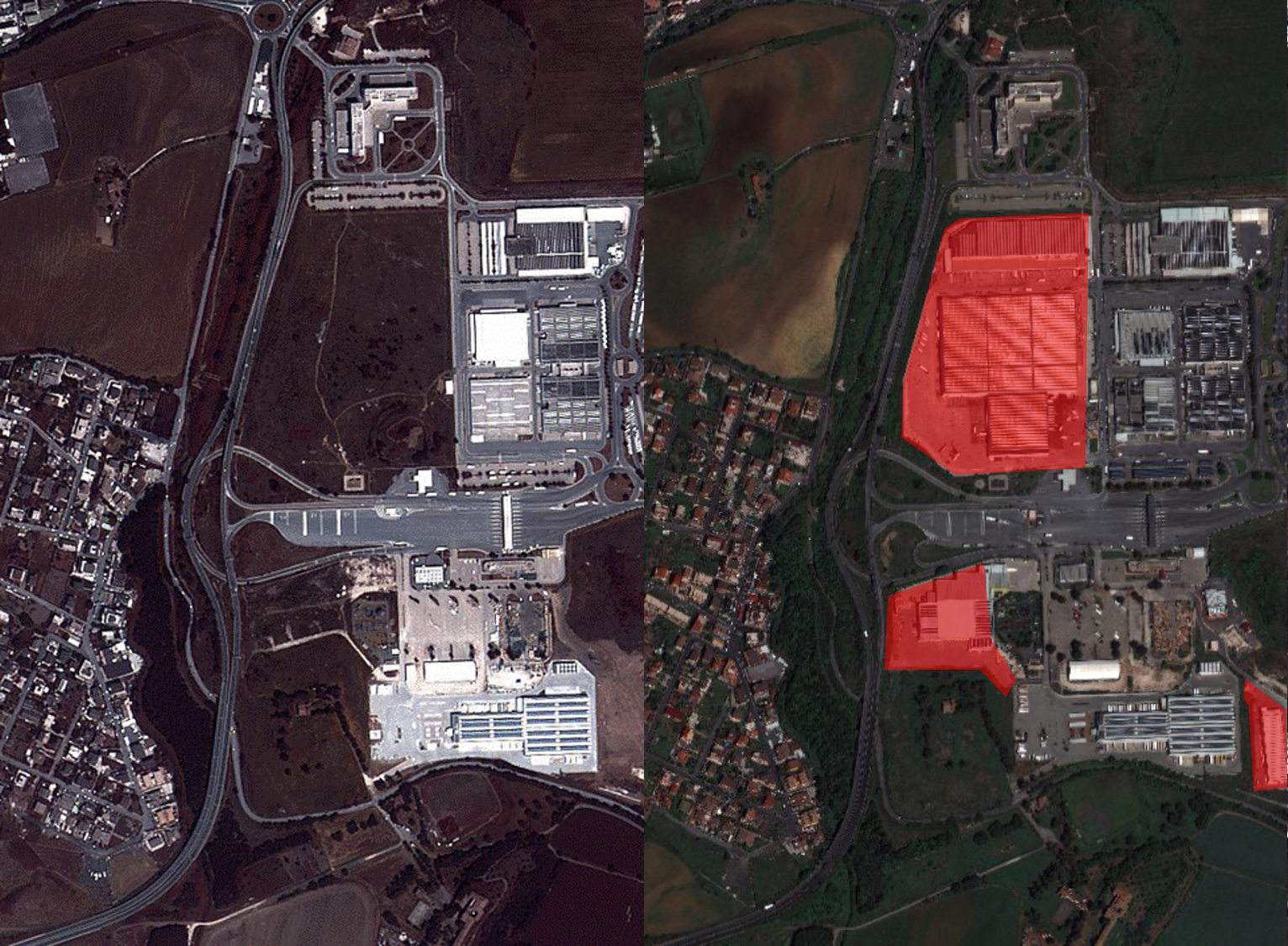
GEO-K develops advanced algorithms based on Artificial Intelligence to detect and monitor land-use changes from natural lands to urban areas, also exploiting time series of satellite products. The analysis take advantages of medium and high resolution multispectral products, increasing the accuracy and speeding up the work of photointerpreters.
related posts:
 https://www.geo-k.co/wp-content/uploads/2016/03/DSC00314_low-e1457531648511_1.png
638
1024
admincl
https://www.geo-k.co/wp-content/uploads/2019/11/NEW_GEO-K_logo_trasp1.png
admincl2016-03-09 12:18:452020-01-15 15:34:58RFIDrone: when a drone reads radiofrequency
 https://www.geo-k.co/wp-content/uploads/2016/02/Senza-titolo3.png
806
1257
admincl
https://www.geo-k.co/wp-content/uploads/2019/11/NEW_GEO-K_logo_trasp1.png
admincl2016-02-15 13:53:122020-01-16 14:28:19GEO-K takes part to the study for super-classification of multispectral data
 https://www.geo-k.co/wp-content/uploads/2015/11/10.png
1728
2304
admincl
https://www.geo-k.co/wp-content/uploads/2019/11/NEW_GEO-K_logo_trasp1.png
admincl2015-11-25 12:21:422020-01-16 13:12:57URBANFLUXES at Rome 2015 Science Symposium on Climate
 https://www.geo-k.co/wp-content/uploads/2015/04/ny-filtered.jpg
899
1354
admincl
https://www.geo-k.co/wp-content/uploads/2019/11/NEW_GEO-K_logo_trasp1.png
admincl2015-04-07 13:51:532020-01-16 14:22:52Urban Imagery for thermal behavior of cities at JURSE 2015