Φsat-2
Enhancing onboard AI processing


ESA Φsat-2 is a miniature satellite – a cubesat – designed to demonstrate how different Artificial Intelligence technologies can advance observing Earth from space. As well as carrying a multispectral imager, Φsat-2’s Artificial Intelligence applications will, for example, eliminate images that are cloudy, detect and classify maritime vessels and transform images into street maps for disaster response.
GEO-K, as part of a consortium from six different European countries leded by Open Cosmos, developed an innovative solution for ɸ-sat-2 that has been selected as the winning idea by a panel of ESA experts. More in detail, GEO-K is responsible for the development of onboard image compression algorithm based on AI (also called deep compression). The model was developed to demonstrate how onboard AI post-processing can reduce the amount of data that is sent to the ground without losing relevant information. Read the annuncement on our blog.
Read more: GEO-K deep compression algorithm for Φsat-2
Read more: ESA Φsat-2 mission

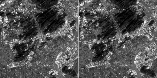
The image shows typical input-output pictures of the Φsat-2 deep compression application. The left image represents the input with full resolution, while the image on the right represents the output of the deep compression app. As the two images show, the aim of the app is to reconstruct the output image with a certain degree of similarity to the input image but compressed, thus requiring less time to be downloaded to ground.
